Bollettino della Rete Sismometrica dell'Italia Nord Orientale
Bulletin of the Seismometric Network of North Eastern Italy
Nel Bollettino vengono elencati tutti gli eventi registrati dalla Rete Sismometrica dell’Italia Nord-Orientale gestita dal Centro Ricerche Sismologiche (CRS) dell'Istituto Nazionale di Oceanografia e di Geofisica Sperimentale – OGS, utilizzando anche i dati delle reti dei seguenti partner:
The Bulletin of the Seismometric Network of North-Eastern Italy, reports all the events recorded by the network of the Seismological Research Center (CRS) that is part of the National Institute of Oceanography and Applied Geophysics – OGS, also using data from these partner networks:
- INGV (Istituto Nazionale di Geofisica e Vulcanologia)
- ARSO (Agencija Republike Slovenije za okolje)
- ETH Zürich (Eidgenössische Technische Hochschule Zürich)
- Università degli Studi di Trieste (RAF - Rete accelerometrica del Friuli Venezia Giulia)
- Provincia Autonoma di Bolzano (Rete sismometrica della Provincia Autonoma di Bolzano)
- Provincia Autonoma di Trento (Rete sismometrica della Provincia Autonoma di Trento)
- Regione Veneto (Rete sismometrica della Regione Veneto)
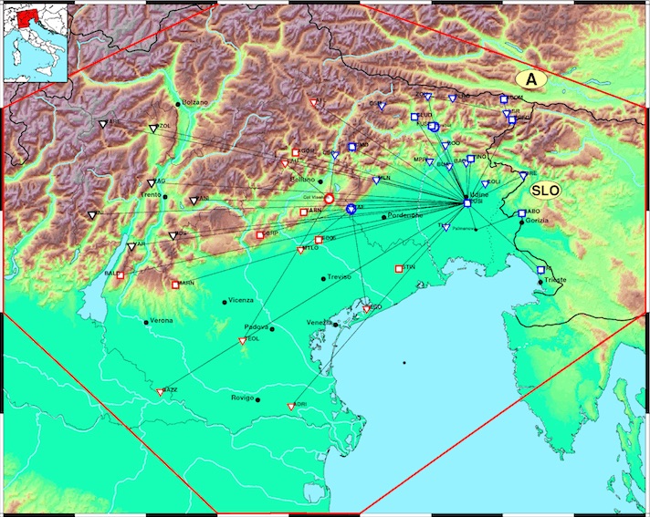
I tempi d’arrivo dei diversi tipi di onda (fasi) vengono determinati con il programma SeisGram2K (Lomax, 2014). Le localizzazioni degli ipocentri sono calcolate con HYPO71 (Lee and Lahr, 1975). Il modello crostale utilizzato è stato calcolato in base alle conoscenze crostali dell’area friulana e della pianura veneta (Slejko et al., 1989). Differenze nei parametri degli eventi rispetto ad altri bollettini sono normali e da imputarsi a possibili differenze nelle letture e nel numero di fasi usate, nel modello di velocità e nei metodi di localizzazione. Il bollettino riporta gli eventi relativi all’area di competenza (lat/lon) (45.5,10.0), (46.5,10.0), (47.0/11.5), (47.0,12.5), (46.5/14.5), (45.5/14.5), (44.5,12.5), (44.5/11.5), corrispondente al poligono visibile sul sito RTS (https://rts.crs.ogs.it).
The arrival times of the different types of waves (phases), are carried out with the SeisGram2K program (Lomax, 2014). Hypocentral determinations are processed using the HYPO71 software (Lee and Lahr, 1975). The used crustal model was defined on the basis of the knowledge about the crust in the Friuli area and the Veneto plain (Slejko et al., 1989). Differences in the localizations of the events, when compared to other bulletins, are due to possible differences in the readings, the number of phases, the speed model and in the localization methods. The Bulletin reports only the events within the area bounded by (lat / lon): (45.5,10.0), (46.5,10.0), (47.0 / 11.5), (47.0,12.5), (46.5 / 14.5), (45.5 / 14.5), (44.5,12.5), (44.5 / 11.5). This polygon is visible on the RTS website map (https://rts.crs.ogs.it).
Il Centro di Ricerche Sismologiche (CRS) fa parte dell'Istituto Nazionale di Oceanografia e di Geofisica Sperimentale – OGS. E’ stato istituito dopo il terremoto del 1976 con il fine istituzionale di “svolgere, in autonomia scientifica, ... con specifici progetti, ricerche sulla sismicità e sulla sismogenesi dell'Italia nord-orientale, gestendo e sviluppando inoltre la connessa rete di rilevamento sismico anche per fini di protezione civile." La rete sismometrica fa parte della Struttura di Monitoraggio dell’Italia Nord Orientale (SMINO) (Bragato et al. 2021) realizzata e gestita da OGS. I dati pubblicati in queste pagine sono di proprietà dell’Istituto Nazionale di Oceanografia e di Geofisica Sperimentale - OGS. Possono essere utilizzati solo per fini non commerciali e non possono essere riprocessati per usi diversi. OGS non si assume la responsabilità per l’uso improprio dei dati. L’utilizzo dei dati in studi e pubblicazioni è permesso con l’obbligo della citazione della fonte utilizzando il relativo DOI.
The Seismological Research Center (CRS) is part of the National Institute of Oceanography and Applied Geophysics – OGS. It was established after the 1976 earthquake with the institutional aim of “... carrying out, in scientific autonomy, ... with specific projects, seismicity research on the seismogenesis of north-eastern Italy, also managing and developing the related seismic detection network also for civil protection purposes.” The seismometric network is part of the Monitoring Structure of North Eastern Italy (SMINO) (Bragato et al. 2021) built and managed by OGS. The data published in these pages are property of the National Institute of Oceanography and Applied Geophysics - OGS – Seismological Research Center (CRS). They can only be used for non-commercial purposes and cannot be reprocessed for different uses. OGS does not assume responsibility for an improper use of data. The use of data in studies and publications is subject with the obligation of citing the source using the relative DOI.
Riferimenti
Riferences
- Lee, W. H. K. and J. C. Lahr (1975). HYP071 (revised): a computer program for determining hypocenter, magnitude, and first motion pattern of local earthquakes, U.S. Geol. Surv. Open-File Rept. 75-311, 116 pp.
- Lomax, A. 2014: SeisGram2K Seismogram Viewer, http://alomax.free.fr/seisgram/SeisGram2K.html.
- Slejko, D., Carulli, G., Nicolich, R., Rebez, A., Zanferrari, A., Cavallin, A., et al. (1989). Seismotectonics of the eastern Southern Alps: a review. Bollettino di Geofisica Teorica e Applicata, 122, 109-136.
- Bragato et. Al 2021. The OGS-Northeastern Italy Seismic and Deformation Network: Current Status and Outlook. Seismological Research Letters, Volume XX, Number XX, 2021, www.srl-online.org.